What's in the kit
Pay once, print as often as you like.
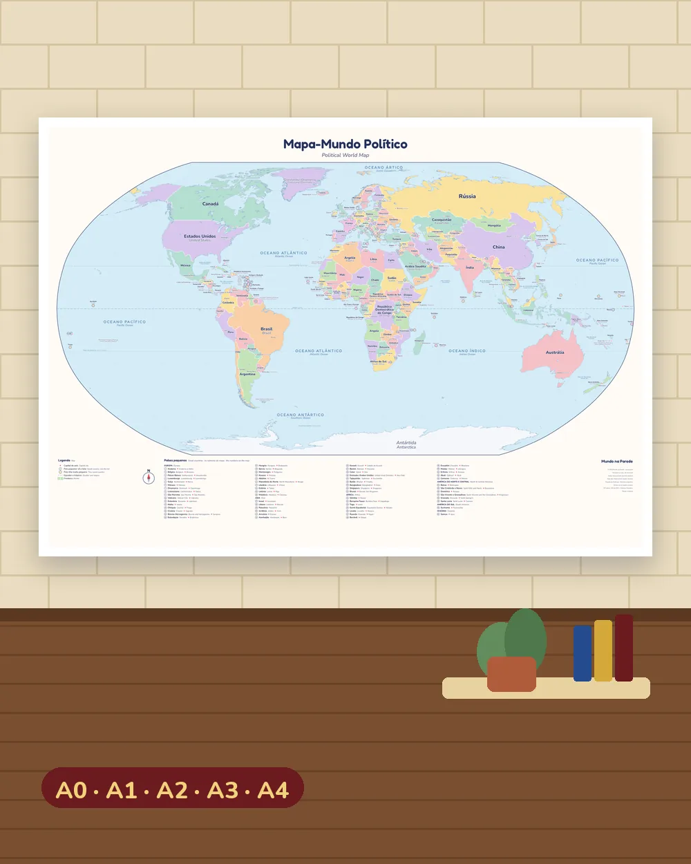
Political World Map
197 countries, capitals and oceans, named in Portuguese and English. In A0, A1, A2 and A3.
Print at home
The map split over 4 or 9 A4 sheets. Glue them together for a map 54 or 80 cm wide.
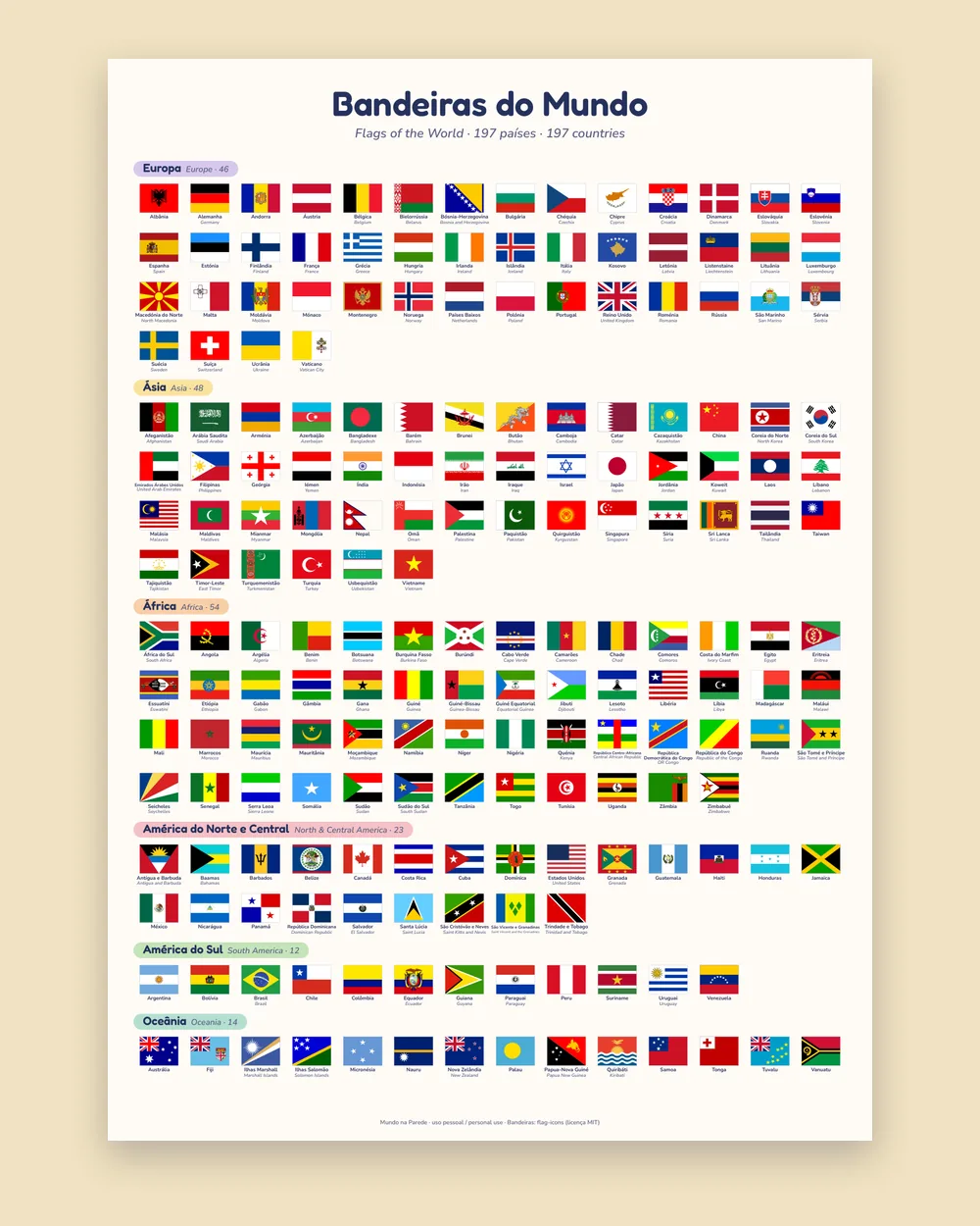
Flags of the World
All 197 flags on one A3/A2 poster and on 5 A4 sheets, one per continent.
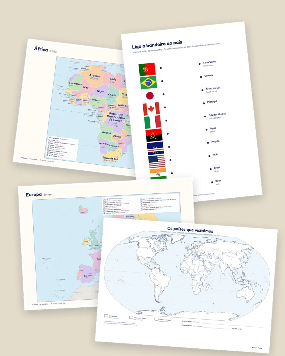
Practice map
A blank world map with 30 numbered countries, 3 worksheets and the answers.
Countries we've visited
A map to colour in your family trips, in A4 and A3.
6 continent maps
Europe, Asia, Africa, North & Central America, South America and Oceania, with capitals.
Countries and capitals list
All 197 countries with flag, Portuguese and English name, and capital.
“Start here” guide
How to print at home or at a print shop, tips and game ideas.
Pick your size
Every size is included. The files are vector PDFs, so they stay sharp even when printed big.
- A44 sheets≈ 54 × 38 cmOn your home printer
- A49 sheets≈ 80 × 56 cmOn your home printer
- A342 × 30 cmAt home or at a print shop
- A259 × 42 cmAt a print shop
- A184 × 59 cmAt a print shop, great for a bedroom
- A0119 × 84 cmAt a print shop, the biggest
What changes at home
- Questions with answers“Where is Japan?” Now you find it together, right there on the wall.
- Two languages, side by sideEvery country has its Portuguese and English name.
- Trips feel biggerFind the destination before the holiday, then colour it in on the travel map.
- Flags and capitalsLearn them through play with the flag poster and the worksheets.
- A prettier bedroomSoft pastel colours that suit a child's room.
- A boost for schoolGeography the easy way, at home.
Order today, get it on WhatsApp
No shipping, no waiting for the post.
- Tap “Order on WhatsApp”: your message is already written.
- We send you the details to pay by MB WAY or a secure payment link.
- Your kit arrives as PDFs on WhatsApp, ready to print.
14-day guarantee
If the kit isn't right for you, message us within 14 days of buying and we'll refund you in full. No questions asked.
Questions
Do I get a paper map?
No. You get PDF files to print. That way you choose the size and can print again whenever you like.
Where do I print the big map?
At any print shop or copy shop. Bring the PDF in the size you want on a USB stick or email it, and ask for 120–170 g matte paper.
Can I print it at home?
Yes. There's an A3 map and a version split over 4 or 9 A4 sheets to glue together. The worksheets, flags by continent and continent maps are A4.
Which languages are on the maps?
European Portuguese (Quénia, Irão, Moscovo…) with the English name under each country. Great for bilingual families and for learning English.
Is the world map up to date?
Yes. All 197 countries and borders follow Natural Earth data with Portugal's official position, and the names are current: Czechia, North Macedonia, Eswatini…
What ages is it for?
For children from about 4 with an adult's help, and for the whole family. The worksheets are made for ages 6 to 12.
How do I pay?
After you message us, we send you the details to pay by MB WAY or a secure payment link.
When do I get it?
As soon as your payment is confirmed, we send the PDFs on WhatsApp, as a .zip file or a download link.
Can I print it more than once?
Yes, for your family or your classroom. You may not resell or share the files.
What if I don't like it?
Message us within 14 days of buying and we'll refund you in full.
Put the world on your wall this week
World map from A4 to A0, flags, practice map with worksheets, travel map, 6 continents and the list of countries and capitals.
€9.90
One-time payment · The files are yours to keep
Order on WhatsApp